Ülesanne 4.1

Ülesanne 4.2
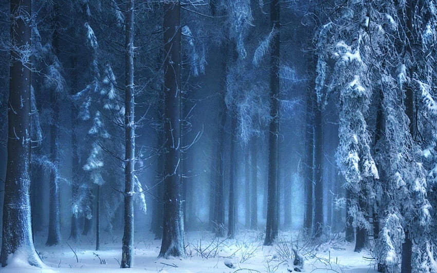
Snow develops in clouds that themselves are part of a larger weather system. The physics of snow crystal development in clouds results from a complex set of variables that include moisture content and temperatures. The resulting shapes of the falling and fallen crystals can be classified into a number of basic shapes and combinations thereof. Occasionally, some plate-like, dendritic and stellar-shaped snowflakes can form under clear sky with a very cold temperature inversion present.[4]
Cloud formation
Snow clouds usually occur in the context of larger weather systems, the most important of which is the low-pressure area, which typically incorporate warm and cold fronts as part of their circulation. Two additional and locally productive sources of snow are lake-effect (also sea-effect) storms and elevation effects, especially in mountains.
Low-pressure areas
Main article: Extratropical cyclone
Extratropical cyclonic snowstorm, February 24, 2007—(Click for animation.)
Mid-latitude cyclones are low-pressure areas which are capable of producing anything from cloudiness and mild snow storms to heavy blizzards.[5] During a hemisphere's fall, winter, and spring, the atmosphere over continents can be cold enough through the depth of the troposphere to cause snowfall. In the Northern Hemisphere, the northern side of the low-pressure area produces the most snow.[6] For the southern mid-latitudes, the side of a cyclone that produces the most snow is the southern side.
Fronts
Main article: Weather front
Frontal snowsquall moving toward Boston, Massachusetts
A cold front, the leading edge of a cooler mass of air, can produce frontal snowsqualls—an intense frontal convective line (similar to a rainband), when temperature is near freezing at the surface. The strong convection that develops has enough moisture to produce whiteout conditions at places which the line passes over as the wind causes intense blowing snow.[7] This type of snowsquall generally lasts less than 30 minutes at any point along its path, but the motion of the line can cover large distances. Frontal squalls may form a short distance ahead of the surface cold front or behind the cold front where there may be a deepening low-pressure system or a series of trough lines which act similar to a traditional cold frontal passage. In situations where squalls develop post-frontally, it is not unusual to have two or three linear squall bands pass in rapid succession separated only by 25 miles (40 kilometers), with each passing the same point roughly 30 minutes apart. In cases where there is a large amount of vertical growth and mixing, the squall may develop embedded cumulonimbus clouds resulting in lightning and thunder which is dubbed thundersnow.
A warm front can produce snow for a period as warm, moist air overrides below-freezing air and creates precipitation at the boundary. Often, snow transitions to rain in the warm sector behind the front.[7]
Lake and ocean effects
Main article: Lake-effect snow
Cold northwesterly wind over Lake Superior and Lake Michigan creating lake-effect snowfall
Lake-effect snow is produced during cooler atmospheric conditions when a cold air mass moves across long expanses of warmer lake water, warming the lower layer of air which picks up water vapor from the lake, rises up through the colder air above, freezes, and is deposited on the leeward (downwind) shores.[8][9]
The same effect occurring over bodies of salt water is termed ocean-effect or bay-effect snow. The effect is enhanced when the moving air mass is uplifted by the orographic influence of higher elevations on the downwind shores. This uplifting can produce narrow but very intense bands of precipitation which may deposit at a rate of many inches of snow each hour, often resulting in a large amount of total snowfall.[10]
The areas affected by lake-effect snow are called snowbelts. These include areas east of the Great Lakes, the west coasts of northern Japan, the Kamchatka Peninsula in Russia, and areas near the Great Salt Lake, Black Sea, Caspian Sea, Baltic Sea, and parts of the northern Atlantic Ocean. Mountain effects
Main article: Precipitation types § Orographic
Orographic or relief snowfall is created when moist air is forced up the windward side of mountain ranges by a large-scale wind flow. The lifting of moist air up the side of a mountain range results in adiabatic cooling, and ultimately condensation and precipitation. Moisture is gradually removed from the air by this process, leaving drier and warmer air on the descending, or leeward, side.[12] The resulting enhanced snowfall,[13] along with the decrease in temperature with elevation,[14] combine to increase snow depth and seasonal persistence of snowpack in snow-prone areas.[1][15]
Mountain waves have also been found to help enhance precipitation amounts downwind of mountain ranges by enhancing the lift needed for condensation and precipitation.[16]
Cloud physics
Main article: Snowflake
Freshly fallen snowflakes
A snowflake consists of roughly 1019 water molecules which are added to its core at different rates and in different patterns depending on the changing temperature and humidity within the atmosphere that the snowflake falls through on its way to the ground. As a result, snowflakes differ from each other though they follow similar patterns.[17][18][19]
Snow crystals form when tiny supercooled cloud droplets (about 10 μm in diameter) freeze. These droplets are able to remain liquid at temperatures lower than −18 °C (0 °F), because to freeze, a few molecules in the droplet need to get together by chance to form an arrangement similar to that in an ice lattice. The droplet freezes around this "nucleus". In warmer clouds, an aerosol particle or "ice nucleus" must be present in (or in contact with) the droplet to act as a nucleus. Ice nuclei are very rare compared to cloud condensation nuclei on which liquid droplets form. Clays, desert dust, and biological particles can be nuclei.[20] Artificial nuclei include particles of silver iodide and dry ice, and these are used to stimulate precipitation in cloud seeding.[21]
Once a droplet has frozen, it grows in the supersaturated environment—one where air is saturated with respect to ice when the temperature is below the freezing point. The droplet then grows by diffusion of water molecules in the air (vapor) onto the ice crystal surface where they are collected. Because water droplets are so much more numerous than the ice crystals, the crystals are able to grow to hundreds of micrometers or millimeters in size at the expense of the water droplets by the Wegener–Bergeron–Findeisen process. These large crystals are an efficient source of precipitation, since they fall through the atmosphere due to their mass, and may collide and stick together in clusters, or aggregates. These aggregates are snowflakes, and are usually the type of ice particle that falls to the ground.[22] Although the ice is clear, scattering of light by the crystal facets and hollows/imperfections mean that the crystals often appear white in color due to diffuse reflection of the whole spectrum of light by the small ice particles.[23] Snow accumulates from a series of snow events, punctuated by freezing and thawing, over areas that are cold enough to retain snow seasonally or perennially. Major snow-prone areas include the Arctic and Antarctic, the Northern Hemisphere, and alpine regions. The liquid equivalent of snowfall may be evaluated using a snow gauge[31] or with a standard rain gauge, adjusted for winter by removal of a funnel and inner cylinder.[32] Both types of gauges melt the accumulated snow and report the amount of water collected.[33] At some automatic weather stations an ultrasonic snow depth sensor may be used to augment the precipitation gauge.[34]
Ülesanne 4.3
Snow develops in clouds that themselves are part of a larger weather system. The physics of snow crystal development in clouds results from a complex set of variables that include moisture content and temperatures. The resulting shapes of the falling and fallen crystals can be classified into a number of basic shapes and combinations thereof. Occasionally, some plate-like, dendritic and stellar-shaped snowflakes can form under clear sky with a very cold temperature inversion present.[4]
Cloud formation
Snow clouds usually occur in the context of larger weather systems, the most important of which is the low-pressure area, which typically incorporate warm and cold fronts as part of their circulation. Two additional and locally productive sources of snow are lake-effect (also sea-effect) storms and elevation effects, especially in mountains.
Low-pressure areas
Main article: Extratropical cyclone
Extratropical cyclonic snowstorm, February 24, 2007—(Click for animation.)
Mid-latitude cyclones are low-pressure areas which are capable of producing anything from cloudiness and mild snow storms to heavy blizzards.[5] During a hemisphere's fall, winter, and spring, the atmosphere over continents can be cold enough through the depth of the troposphere to cause snowfall. In the Northern Hemisphere, the northern side of the low-pressure area produces the most snow.[6] For the southern mid-latitudes, the side of a cyclone that produces the most snow is the southern side.
Fronts
Main article: Weather front
Frontal snowsquall moving toward Boston, Massachusetts
A cold front, the leading edge of a cooler mass of air, can produce frontal snowsqualls—an intense frontal convective line (similar to a rainband), when temperature is near freezing at the surface. The strong convection that develops has enough moisture to produce whiteout conditions at places which the line passes over as the wind causes intense blowing snow.[7] This type of snowsquall generally lasts less than 30 minutes at any point along its path, but the motion of the line can cover large distances. Frontal squalls may form a short distance ahead of the surface cold front or behind the cold front where there may be a deepening low-pressure system or a series of trough lines which act similar to a traditional cold frontal passage. In situations where squalls develop post-frontally, it is not unusual to have two or three linear squall bands pass in rapid succession separated only by 25 miles (40 kilometers), with each passing the same point roughly 30 minutes apart. In cases where there is a large amount of vertical growth and mixing, the squall may develop embedded cumulonimbus clouds resulting in lightning and thunder which is dubbed thundersnow.
A warm front can produce snow for a period as warm, moist air overrides below-freezing air and creates precipitation at the boundary. Often, snow transitions to rain in the warm sector behind the front.[7]
Lake and ocean effects
Main article: Lake-effect snow
Cold northwesterly wind over Lake Superior and Lake Michigan creating lake-effect snowfall
Lake-effect snow is produced during cooler atmospheric conditions when a cold air mass moves across long expanses of warmer lake water, warming the lower layer of air which picks up water vapor from the lake, rises up through the colder air above, freezes, and is deposited on the leeward (downwind) shores.[8][9]
The same effect occurring over bodies of salt water is termed ocean-effect or bay-effect snow. The effect is enhanced when the moving air mass is uplifted by the orographic influence of higher elevations on the downwind shores. This uplifting can produce narrow but very intense bands of precipitation which may deposit at a rate of many inches of snow each hour, often resulting in a large amount of total snowfall. Mountain effects
Main article: Precipitation types § Orographic
Orographic or relief snowfall is created when moist air is forced up the windward side of mountain ranges by a large-scale wind flow. The lifting of moist air up the side of a mountain range results in adiabatic cooling, and ultimately condensation and precipitation. Moisture is gradually removed from the air by this process, leaving drier and warmer air on the descending, or leeward, side.[12] The resulting enhanced snowfall,[13] along with the decrease in temperature with elevation,[14] combine to increase snow depth and seasonal persistence of snowpack in snow-prone areas.[1][15]
Mountain waves have also been found to help enhance precipitation amounts downwind of mountain ranges by enhancing the lift needed for condensation and precipitation.[16]
Cloud physics
Main article: Snowflake
Freshly fallen snowflakes
A snowflake consists of roughly 1019 water molecules which are added to its core at different rates and in different patterns depending on the changing temperature and humidity within the atmosphere that the snowflake falls through on its way to the ground. As a result, snowflakes differ from each other though they follow similar patterns.[17][18][19]
Snow crystals form when tiny supercooled cloud droplets (about 10 μm in diameter) freeze. These droplets are able to remain liquid at temperatures lower than −18 °C (0 °F), because to freeze, a few molecules in the droplet need to get together by chance to form an arrangement similar to that in an ice lattice. The droplet freezes around this "nucleus". In warmer clouds, an aerosol particle or "ice nucleus" must be present in (or in contact with) the droplet to act as a nucleus. Ice nuclei are very rare compared to cloud condensation nuclei on which liquid droplets form. Clays, desert dust, and biological particles can be nuclei.[20] Artificial nuclei include particles of silver iodide and dry ice, and these are used to stimulate precipitation in cloud seeding.[21]
Once a droplet has frozen, it grows in the supersaturated environment—one where air is saturated with respect to ice when the temperature is below the freezing point. The droplet then grows by diffusion of water molecules in the air (vapor) onto the ice crystal surface where they are collected. Because water droplets are so much more numerous than the ice crystals, the crystals are able to grow to hundreds of micrometers or millimeters in size at the expense of the water droplets by the Wegener–Bergeron–Findeisen process. These large crystals are an efficient source of precipitation, since they fall through the atmosphere due to their mass, and may collide and stick together in clusters, or aggregates. These aggregates are snowflakes, and are usually the type of ice particle that falls to the ground.[22] Although the ice is clear, scattering of light by the crystal facets and hollows/imperfections mean that the crystals often appear white in color due to diffuse reflection of the whole spectrum of light by the small ice particles.[23]
The areas affected by lake-effect snow are called snowbelts. These include areas east of the Great Lakes, the west coasts of northern Japan, the Kamchatka Peninsula in Russia, and areas near the Great Salt Lake, Black Sea, Caspian Sea, Baltic Sea, and parts of the northern Atlantic Ocean. Snow accumulates from a series of snow events, punctuated by freezing and thawing, over areas that are cold enough to retain snow seasonally or perennially. Major snow-prone areas include the Arctic and Antarctic, the Northern Hemisphere, and alpine regions. The liquid equivalent of snowfall may be evaluated using a snow gauge[31] or with a standard rain gauge, adjusted for winter by removal of a funnel and inner cylinder.[32] Both types of gauges melt the accumulated snow and report the amount of water collected.[33] At some automatic weather stations an ultrasonic snow depth sensor may be used to augment the precipitation gauge.[34]
Ülesanne 5.1
Tunniplaan
| Esmaspäev |
Teisipäev |
Kolmapäev |
Neljapäev |
Reede |
| |
|
8:30 kasutab tavakasutaja tasemel enamlevinud tarkvaralahendusi |
|
8:30 kasutab veebirakenduses kasutatavaid märgendikeeli ja stiililehti ning oskab nende abil kujundada soovitud väljundi, mis vastab W3C standardile ja parimatele praktikatele; |
| |
|
10:15 kasutab veebirakenduses kasutatavaid märgendikeeli ja stiililehti ning oskab nende abil kujundada soovitud väljundi, mis vastab W3C standardile ja parimatele praktikatele; |
10:15 kasutab tavakasutaja tasemel enamlevinud tarkvaralahendusi; |
10:15 Suhtlemine IT-valdkonnas |
| |
|
11:55 tunneb erinevaid andmetüüpe ja andmestruktuure |
11:55 Kasutab matemaatika ja loogika põhiseoseid_R1 |
11:55 Suhtlemine IT-valdkonnas |
| |
|
14:10 Kasutab matemaatika ja loogika põhiseoseid_R1 |
|
|
| |
|
15:45 tunneb erinevaid andmetüüpe ja andmestruktuure |
|
|
Ülesanne 5.2
|
Lumi ja lumi |
Ülesanne 5.3
Kaja Kallas lahkumiskõlakast: surve on suur, aga praegu mul ei ole sellist plaani, et tagasi astuda |
| Valitsus arutab täna-homme Vihula mõisas tuleva aasta riigieelarvet. Seis on pingeline ning peaminister Kaja Kallas viitas, et päästjatel, politseinikel ja õpetajatel palgatõusu oodata ei tasu. Intervjuus on idavedude skandaali valguses juttu Kallase enda positsioonist. |
Ta on ka ise kuulnud kuulujuttu justkui astuvat ta peagi tagasi. Valitsuse pressikonverents toimus täna erandlikult tavapärase südapäeva asemel kell 10. Kui selle järel intervjuud antud, asusid ministrid teele Vihulasse. Ilmselt venivad nii tänane kui homne arutelu õhtusse välja. Märksõnaks on teatavasti kärpimine, mis valus teema. |
Delfi uuris Kallaselt, kas tema hinnangul on ministrid teinud piisavalt, et oma valdkonnas võimalikke kärpekohti leida. „Osad ministrid on kindlasti teinud rohkem kui teised. See kriitika küll on, et mõni ütleb, et midagi teha ei saa. Osad aga on väga tublid,“ sõnas ta. „Eks me seda täna arutame. Tekitab ebavõrdset olukorda valitsuses, kui ühed
hoiavad kokku ja teised ütlevad, et ei, kõik peaks jätkuma nii, nagu ta on. Ja tegelikult peaks veel raha kõigile peale panema.“ |
Ülesanne 5.3 (Lisa ülesanne?)
Vabariigi President Vabariigi aastapäeva kontserdil ja vastuvõtul Eesti Rahva Muuseumis |
| "Soovin teile südamest õnne... |
Eks sedagi ole hea märkida... |
Aga mida tähendab väärikas riik?... |
Ülesanne 5.4
| 2023 Miami Grand Prix |
| 7.mai 2023 |
1. Max Verstappen |
| 2. Sergio Pérez |
| 3. Fernando Alonso |
| 4. George Russell |
| 5. Carlos Sainz Jr. |